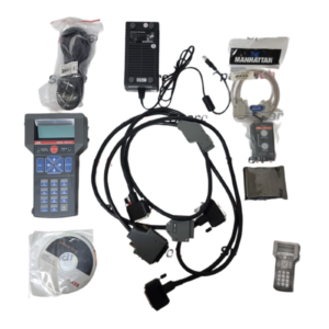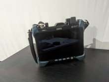
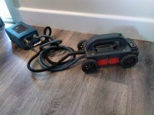
GSSI Ground Penetrating Radar (GPR) System
GSSI (Geophysical Survey Systems Inc of Salem, New Hampshire) is a leading maker of ground penetrating radar equipment. A GPR system sends short radar pulses into the ground or a structure and records the reflections from buried objects and layer boundaries so operators can see beneath the surface without digging coring or cutting. GSSI systems are used for concrete inspection utility mapping and locating road and bridge deck evaluation geophysics and archaeology.
Key Features (Typical GSSI Systems)
- Control unit plus antenna: a GPR system pairs a controller with an antenna and the antenna frequency sets the trade off between depth and resolution
- Modular control units: for example the SIR 4000 works with GSSI digital and analog antennas, and offers collection modules including Quick 3D, UtilityScan, StructureScan, and Expert Mode
- Large, bright display: the SIR 4000 has a 10.4-inch high definition LED display, a simple user interface, plug and play GPS integration, and Wi-Fi data transfer
- Rugged build: a cast aluminum chassis for temperature stability and an impact resistant, IP65 rated design that withstands tough jobsite conditions
- Field processing: advanced display methods, filtering, on the fly automatic gain, and target marking, while saving raw data for post processing
- 2D and 3D data collection: 3D imaging of a survey area with an x ray like view of what’s in the concrete
- Antenna choices: from high frequency concrete antennas (such as 1600 MHz and 2600 MHz on the StructureScan Pro reaching depths of about 0 to 18 inches) to lower frequency antennas for utilities and geology, and dual frequency options such as the 300/800 MHz UtilityScan DF
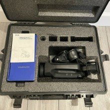
- Standard package (SIR 4000): the control unit, sunshade, two lithium ion batteries, a dual bay charger, a transit case, and a user manual, with a two year warranty
- RADAN software: Windows based post processing software for analyzing and reporting data
Typical Applications
- Concrete inspection locating rebar post tension cables conduits and voids and measuring slab thickness before cutting or coring
- Utility designation and underground mapping
- Bridge deck, road, and pavement evaluation
- Mining, geology, and environmental assessment
- Archaeology and forensics
Why Choose It
GSSI Ground Penetrating systems offer proven GPR performance with simple operation from entry level concrete scanners to full featured controllers that work with many antennas. They help crews avoid utility strikes and damage to embedded elements.